A modern border surveillance system is no longer a single camera installed on a tower. For government contractors, border security integrators, and large perimeter projects, the design challenge is to combine wide-area detection, long-distance verification, low false alarm rates, stable transmission, and command center response into one integrated architecture.
In practical deployments, this usually means combining ground surveillance radar, thermal PTZ cameras, long-range optical cameras, laser rangefinders, edge AI, and a centralized platform. JEC’s border surveillance solution follows this system-level direction by integrating multi-sensor perception, AI recognition, network transmission, and command dispatch for land borders, coastal lines, mountains, deserts, rivers, and checkpoints.
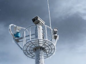
 border surveillance system with multi-sensor thermal PTZ camera
Why Border Surveillance Requires Multi-Sensor Design
Manual patrols and single-video monitoring often leave blind zones in remote terrain. A fixed visible camera may work in daylight, but it can lose effectiveness in darkness, fog, glare, dust, rain, or complex backgrounds. A standalone thermal camera can detect heat signatures, but it may not provide enough detail for positive visual identification. Radar can detect movement over a wide area, but it needs optical confirmation.
That is why an engineering-grade thermal surveillance system should be designed as a sensor fusion workflow:
Detect with radar → verify with thermal PTZ → identify with long-range visible optics → range and track the target → trigger command center response.
This design reduces dependence on manual monitoring and helps operators focus on confirmed events rather than watching dozens of video feeds continuously. Border surveillance systems are commonly used to support situational awareness and assist in detecting and identifying border activities; the U.S. DHS describes Border Surveillance Systems as tools used for comprehensive situational awareness and support in detecting and identifying illegal border activity.
Key Components of a Modern Border Surveillance System
A complete border surveillance system should be designed around the mission, not around one device. The major components include:
1. Ground Surveillance Radar
Radar provides wide-area motion detection over open terrain. It is useful for detecting moving persons, vehicles, boats, or low-speed targets before they enter the camera’s narrow field of view. Radar is especially valuable in desert, coastal, river, and open-border applications.
2. Thermal PTZ Camera
A thermal PTZ border surveillance camera enables day/night detection and confirmation without relying on visible light. For long-range perimeter monitoring, thermal imaging is often used to detect suspicious movement in darkness, vegetation edges, or low-visibility conditions.
3. Long-Range Optical Camera
A long-range surveillance camera with high optical zoom is required for visual identification. After radar or thermal imaging detects a target, the visible camera helps operators verify whether the target is a person, vehicle, animal, patrol team, or authorized activity.
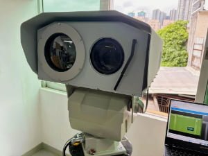
4. EO/IR PTZ Camera Platform
An EO/IR PTZ camera combines electro-optical visible imaging and infrared thermal imaging in one pan-tilt platform. JEC’s long-range EO/IR PTZ camera supports modular integration of visible zoom camera, thermal module, laser illuminator, laser rangefinder, and radar/AI tracking system, making it suitable for project-based border and perimeter applications.
5. Laser Rangefinder
A laser rangefinder gives the command center accurate distance information. This is important when dispatch teams need to know not only what the target is, but also where it is and how far it is from the protected line, fence, tower, checkpoint, or patrol road.
6. Edge AI and Command Platform
AI can help classify targets, filter false alarms, trigger intrusion rules, and support trajectory tracking. In JEC’s border solution architecture, the cloud-edge/application layer supports target classification, intrusion detection, trajectory tracking, abnormal behavior recognition, and integrated command dispatch.
How Radar and PTZ Cameras Work Together
The value of radar PTZ integration is automation. Instead of waiting for an operator to manually search a large scene, the radar detects a moving object and sends its coordinates to the PTZ camera.
A practical workflow looks like this:
- Radar detects movement across a wide border sector.
- The platform filters the alarm based on speed, direction, target size, zone rules, and known exclusion areas.
- The PTZ camera automatically slews to the target location.
- Thermal imaging confirms the presence of a heat signature.
- Long-range visible optics zoom in for visual identification.
- Laser rangefinding provides distance data.
- AI tracking keeps the PTZ camera locked on the target.
- The command center receives video, location, alarm type, and response instructions.
This detection-to-verification-to-tracking loop is the core of a professional border surveillance system.
Choosing the Right Thermal PTZ for Border Surveillance
For contractors, the best camera is not always the one with the longest advertised range. The right choice depends on terrain, tower height, target size, environmental conditions, bandwidth, power supply, and integration platform.
When selecting a thermal PTZ camera, evaluate:
| Design Factor | What to Check |
|---|---|
| Thermal resolution | 640×512 or higher for better long-range target confirmation |
| Thermal lens | Fixed or zoom thermal lens depending on sector width and target distance |
| Visible zoom | 30x, 55x, 92x, or project-specific long focal length optics |
| Pan-tilt performance | 360° continuous pan, accurate positioning, stable tracking |
| Rugged design | IP66/IP67, wide-temperature operation, anti-surge protection |
| System protocol | ONVIF, PELCO-D, RS485/RS422, alarm I/O, VMS compatibility |
| AI features | Intrusion detection, target classification, motion tracking |
| Payload expansion | Radar linkage, laser rangefinder, GPS, laser illuminator |
JEC’s multi-sensor thermal PTZ model includes 55x optical zoom, 640×512 thermal imaging, direct-drive pan-tilt, IP66 protection, wide-temperature operation, laser ranging, and ONVIF/PELCO-D integration options.
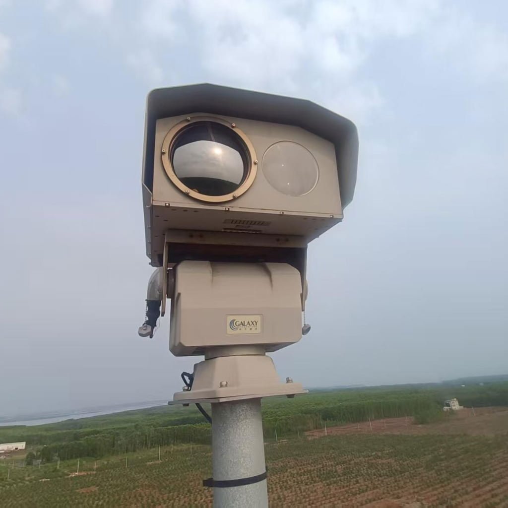
thermal PTZ camera for long-range border surveillance and perimeter monitoring
Deployment Scenarios
Desert Border
Desert areas require long-distance detection, heat-tolerant housings, anti-dust design, and stable optics. Radar can cover open ground, while thermal PTZ cameras verify movement at night.
Mountain Border
Mountain terrain creates blind zones and elevation challenges. Towers should be positioned based on line-of-sight analysis, and PTZ cameras should support precise pan-tilt movement for valley, ridge, and trail monitoring.
Coastal Border
Coastal applications need anti-corrosion protection, thermal imaging, long-range visible optics, and radar linkage for boats, shoreline movement, and restricted coastal zones.
River Crossing
River borders require radar and thermal cameras to monitor crossing points, small boats, riverbanks, and night movement. Laser rangefinding helps operators locate the event more accurately.
Checkpoint and Road Corridor
For border checkpoints, the system should combine PTZ cameras, fixed cameras, license plate capture, access control, and command center recording.
Remote Perimeter
For remote perimeter monitoring, the design should consider solar power, battery backup, microwave transmission, satellite communication, and low-bandwidth video strategies.
System Architecture Example
A scalable border surveillance system can be organized into three layers:
1. Perception Layer
This layer includes ground radar, thermal PTZ cameras, long-range optical cameras, laser detectors, vibration sensors, fiber optic perimeter alarms, UAV-mounted sensors, and checkpoint cameras.
2. Transmission Layer
This layer may use fiber optic cable, 5G, microwave backhaul, satellite communication, or hybrid transmission depending on site conditions. JEC’s border solution page specifically mentions satellite communication, 5G, microwave backhaul, and long-distance optical fiber for remote transmission.
3. Cloud-Edge and Application Layer
This layer includes edge AI, local NVR/VMS, central command platform, map visualization, alarm rules, video wall, evidence storage, and dispatch workflow.
Design Checklist for Contractors
Before asking for a quotation, contractors should define the following:
- Border length and number of sectors
- Terrain type: desert, mountain, coastal, river, forest, road, or checkpoint
- Target type: person, vehicle, boat, UAV, animal, or mixed target
- Required detection, recognition, and identification distance
- Tower height and installation points
- Radar coverage angle and camera field of view
- Thermal lens and visible lens requirements
- Power supply: grid, solar, hybrid, or battery backup
- Network transmission: fiber, 5G, microwave, satellite, or mixed
- VMS/NVR platform and protocol requirements
- Alarm workflow and command center response process
- Maintenance access and spare parts plan
- Compliance documents: ISO, CE, FCC, RoHS, project-specific certificates
CTA: Send your border length, terrain type, target distance, and integration platform. JEC PTZ engineers can recommend a thermal PTZ + radar surveillance configuration for your project.